October 20-27, 2012... Hiding in Georgia from Hurricane Sandy


We were intent on getting as far south as we could -- our ‘deadline’ was to get to Delray Beach, Florida in time to vote in the Presidential election -- every vote counts -- especially in Florida.  But, the weather news was bad.  A tropical storm was brewing in the Caribbean that would eventually ride up the US east coast.  Landfall was still unknown; tropical winds were expected everywhere.  The Bahamas and Florida were in the path, but the storm would likely veer east.  We had an opportunity to get from Charleston to Cumberland Island at the GA-FL border, as far west as you can get on the east coast.  Turned out to be a smart move as this was about the ONLY place on the entire east coast that escaped Sandy.  

We set out with Gem on Saturday morning and had the anchor down by Sunday afternoon.  Cumberland was as beautiful as we remembered.  We walked along the beach where horses were busy eating, not caring if we came by.  Wild turkeys promenaded along as we walked to the Dungeness ruins.


But enough about wildlife.  This was election season and MV & Shane invited us over for a presidential debate party.  (Its great to have Australian friends who take as much an interest in our politics as we do)  What a novelty for us to watch TV on a boat!  And the debate was pretty good -- Obama got his line in about the changing nature of warfare (bayonets and horses) -- we were pretty entertained.  Of course this reminded us that we needed to get another 300 miles south to vote... and Sandy was getting closer.

Next day the waters near Cumberland were getting noticeably rougher and we started thinking about moving inland a little more.  We found the North River on the charts; a serpentine waterway in the marshes a couple of miles west towards St. Mary’s.  John called the boatyard there to ask about conditions -- when they said all the locals ride out storms up there, that was all we needed to hear.  Gem took the lead and we headed over, with Shane calling out depth soundings to us on the radio.  Three twists upriver and we anchored far enough in to avoid any storm surge -- plenty of marsh between us and the rivers/ocean.  We stayed in the marsh till Sandy passed by -- and never saw sustained winds over 25 knots.  While waiting, we had time to explore the town of St Mary’s, visit the Saturday market, eat local shrimp, and look for alligators.  


But we were all getting restless.  Even though the eye of the storm passed by, the winds and seas were forecast to stay elevated for days after.  We parted company with Gem and decided to go south inside to St. Augustine, making tracks while the remains of Sandy raged outside.  Gem was too tall for the bridges -- they headed back to Cumberland to wait for the window to travel on the ocean.

Cumberland Island:  30d45.928’N  81d28.335’W
North River off St. Mary’s River:  30d44.191’N  81d31.760’W

October 9-19, 2012... The Southward Migration...VA...NC...SC


We waited what seemed an eternity for the right weather window to leave the Chesapeake and sail outside around Hatteras, and south.  We were getting too cold to stay north as nighttime temps fell into the 40s with every cold front that moved through.  But, the fronts were bringing rough weather and we didn’t want to start our journey south in a storm.  After 3 days of waiting it seemed we might catch a break, so we ventured out from our sheltered anchorage and sailed across Mobjack Bay (which seemed much tamer than the forecast conditions) and were exiting Mobjack to the Chesapeake proper, when, wham!!  OK, now we knew what the forecasters were talking about.  Winds were in the 20-25+ knots range and the seas were rough.  And this was on the Bay.  The conditions outside were worse.  We decided then and there to make miles south by going inside to Beaufort, NC and then look for better weather to sail on the ocean.  So, we headed to Willoughby Bay and put the anchor down.

Our days became mind-numbing drives down the ICW, bridges, locks, boat traffic, radio chatter, eyes glued to the depth sounder, every evening conversations about where to anchor.  And every morning waking to bone chilling temperatures requiring us to wear all our foulie gear until afternoon when the sun would warm us up in the enclosure.  We took some small comfort in sailing a little bit -- we had a good downwind sail on the Albemarle Sound, a fast sail on the Pungo River, and again on the Pamlico and Neuse.  


As we got further south in North Carolina, the weather started turning warm!  By the time we got to Beaufort, we were in t-shirts again.  From Beaufort, we got a decent weather window to go outside.  And, we sailed for about 6 hours before the winds died completely.  So, rather than drive on the ocean and arrive in Charleston at night, we cut the trip short and went into Winyah Bay, anchoring near the lighthouse -- our bailout the last time we sailed out of Beaufort 3 years ago!  


So, inside again, setting the anchor in the marshes off Isle of Palms near Charleston.  There we had great news as Maryvonne and Shane on Gem were headed into Charleston.  The next day we met at the anchorage off the city marina, and spent the day in town catching up and making plans to travel together as we were both headed south.


Willoughby Bay:  +36° 57' 37.62", -76° 17' 21.60"
Pungo Ferry Bridge:  +36° 36' 40.08", -76° 3' 5.34"
Little Alligator River:  +35° 56' 9.00", -76° 1' 4.56"
Slade Creek, Pungo River:  +35° 27' 50.40", -76° 32' 46.50"
Beaufort, NC:  +34° 42' 45.06", -76° 40' 47.28"
Winyah Bay, SC:  +33° 13' 13.32", -79° 11' 10.26"
Inlet Creek:  +32° 46' 59.88", -79° 49' 30.66"
Charleston:  +32° 46' 32.46", -79° 57' 7.50"

Catch-up Time

We made it south to Florida and have the luxury of time and wifi access.  So, we are updating our blog with posts from the summer till now.  Enjoy! 

September 20 - October 9, 2012... Chesapeake Cruising


You may have noted gaps in our blogging over the summer.  We’ve just been a little busy with Jay’s move to Oregon (we went out there to see Corvallis and make sure Jay was well established), and other non-boat issues occupying our time in August and September.  We kept Anhinga at Sarles through mid-September, finally breaking free for good.  With fall coming on, we started our migration down the Chesapeake Bay.  Our general mission was to find warmer weather, though we also wanted to see places we hadn’t been before.  

Our first stop was Hudson Creek on the Little Choptank River.  The first thing we noticed was the quiet.  Again, it is amazing how we can get used to noise when living in a more densely populated place.  Getting into the kayak for our first exploration, we saw a turtle swimming nearby.  Just a little guy, but exciting just the same.  Hudson is oriented north-south, and the cold fronts were funneling north winds right down the creek.  This made paddling more than challenging, and it whipped up the water making our anchorage a bit uncomfortable.  So, on the second day we moved off the creek into a cove to get a little more lee.  This was an interesting place to paddle, the houses along the shore ranging from the very modest to the very palatial.  We went all the way to the end, hiding from the wind and water behind marshy shores and stands of trees.

Our next destination was Smith Island.  Every time we go through the Bay, we try to stop there and never have, so this was to be our chance.  We didn’t get an early enough start from Hudson, so the first night we stopped over in the Honga River, and finished the trip the next day.  We had a beautiful sail (saw pelicans!! we are south again!!) and anchored north of Smith, just past Swan Island, in the channel that goes east to Tangier Sound.  This channel is deep enough for us, but only 150 feet wide before the bottom comes up for the marshes.  We anchored exactly in the middle, keeping our keel a couple of feet above ground.  We spent the early evening enjoying the egrets, herons, and bald eagle!! and planned on visiting the island the next day.  But, we woke up to a roaring wind and we had shifted slightly out of the channel and were hitting bottom.  There was no way we would be able to stay.  The weather reports indicated that the wind was only going to get worse that night and the next day, so we needed to leave while the weather was ‘less bad’!  Easily pulling off the mud, we left Smith Island -- a place we are destined to never visit.  We bumped our way through the square waves in the worst weather we had ever experienced on the Bay, and headed for shelter on the Western Shore.

Checking the charts, we saw that Mill Creek off Ingram Bay offered pretty good protection.  Up we went, found a cove with still water, dropped the hook, and breathed.  It hadn’t been a good day, but the evening was promising a beautiful sunset, and we were safe and comfortable.  We ended up staying in Mill Creek for 4 nights.  This was an absolutely beautiful place, we paddled the creek, out to Ingram Bay, and several other creeks.  The water was clear and we could see the rays that swam under our kayak.  One night we noticed a familiar boat pull into the anchorage.  Our friend Phil on Sweet Pea had come in from Solomons, so we got to catch up after not seeing each other since the Bahamas two years ago.  That’s cruising.


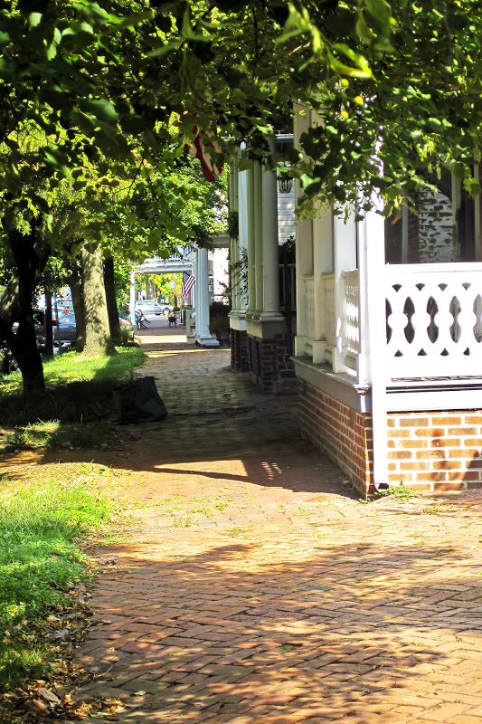
Another place we had been before, though not by water, was Urbanna, Virginia.  We liked the town and thought if we ever had a chance, we would go up the Rappahannock River to visit.  So, 16 miles up the river we went and anchored off the town dock.  Here we were able to re-provision, do laundry, and eat out.  People were very nice to us, welcoming us to town, offering us rides and even their cars to help us out while we were here.  We even had a great blue heron welcome us -- sitting either on our hoisted dinghy or the solar panel, not caring if we got close.  The weather was less cooperative, and we had a couple of pretty wet days, and we waited for yet another cold front to turn the wind so that we could sail down the river.


But first, we wanted to fill up on fuel, and Urbanna had none, so we went across the Rappahannock to Irvington.  Up Carter Creek, we got fuel, water, and a beautiful place to anchor.  And lots of creeks and side creeks to explore by kayak.  How is it possible that there are all these beautiful homes on all these rivers and creeks?  Who are these people?  Well, we’ll never know -- we left the next day to go downriver.  We actually had somewhere we wanted to be -- the Blues and Brews Festival in Gloucester, Virginia.

Thursday we sailed up Mobjack Bay, found the Ware River and headed past shoally shores to a pretty corner and anchored.  Having scoped out the river on google maps imagery, we knew that the public boat ramp was only a mile and a half away -- an easy enough paddle.  And the road to town was only a couple of miles from there.  Friday we would do a recon run to make sure we would be able to make it to the festival.  But Friday morning we woke up to a major emergency -- our coffee pot was broken.  So the recon run turned into a shopping expedition.  Finding no place to buy a coffee pot in downtown Gloucester, we walked the highway to Walmart.  We found a pot and will not go into caffeine withdrawal.  And yes, Saturday we got to the festival, danced and listened to wonderful bands from southern Virginia, and made it back to Anhinga, tired, but happy.  (BTW - there are bald eagles here too!!)


Hudson Creek, Little Choptank River:  anchorage 1:  +38° 32' 28.20", -76° 14' 41.88"
anchorage 2:  +38° 34' 15.24", -76° 14' 50.64"
Asquith Island, Honga River:  +38° 16' 34.50", -76° 7' 44.04"
Smith Island:  +38° 0' 17.58", -76° 2' 9.12"
Mill Creek, Ingram Bay:  +37° 47' 31.44", -76° 19' 22.56"
Urbanna Creek, Rappahannock River:  +37° 38' 13.44", -76° 34' 8.58"
Carter Creek, Rappahannock River:  +37° 39' 55.92", -76° 26' 5.46"
Ware River, Mobjack Bay:  +37° 23' 34.32", -76° 27' 33.72"

August 6-15, 2012... Escape from the Dock!


We got itchy feet sitting at the dock, and needed to feel Anhinga swinging at anchor again.  So, we took a mini-cruise up to the Chester River on the Eastern Shore, first stopping at Whitehall Bay, just to make sure all our improvements on the boat were in good working order.  From there we headed to the Chester, turning into Langford Creek, a place we hadn’t been before.  As we puttered up the creek we got a glimpse of the bucolic setting east of Cacaway Island, so turned in there and anchored.  Ahhh... so far from the hustle and bustle of Annapolis.  We kayaked a few miles up the East Fork to the end, and though exhausted from the effort, we were rewarded with a bald eagle sighting.  Magnificent!


Next we moved the boat up to the West Fork of Langford, anchoring near the public boat ramp.  This is a beautiful spot, and crabbers were still working the creek, making bushelfuls of crabs each day.  Great seeing that the waters are so productive.  The boat ramp location was key to our next couple of excursions, which required land access.  

First, we were on the search for Tallulah.  Yes, Tallulah Bankhead -- actress and personality of the 1930s and 40s.  She is buried at St Paul’s Church graveyard off the West Fork.  Why would a larger than life star of Hollywood and London, resident of New York, end up on the Eastern Shore?  We went to find out.  So, paddling over to the ramp, we beached the kayak and walked up the road past cornfields to the main road that took us to the cemetery.  We unsuccessfully searched the grounds, so went into the church office to ask for guidance.  Not the first to ever go looking for Tallulah, the office was ready with printed directions.  We found Tallulah, buried next to her sister and brother (?) near the water.  And that is why she is here, because her sister took care of her at the end of her life.


Our next excursion was in the other direction to Rock Hall.  It was Pirates and Wenches Fantasy Weekend -- a big annual event.  This small town attracts lots of people dressed in full pirate regalia and there is music and other entertainment all over town.  We figured, why not?  Though we didn’t have the appropriate costumes, we enjoyed everyone else’s get-ups, the decorated houses in town, the music and the circus acts.


Our next challenge was the sail up the river to Chestertown.  Winds were light, but we eventually got there, anchored off the town dock, and swung back and forth with the current.  We visited town, which was quiet and pretty, then realized we needed to leave to get back to Annapolis, to get ready for our trip to Oregon to take Jay to college.  We wanted to stop first further down the Chester to break up the return trip.  So, back to the Corsica River, a place we had visited before, for our last night of Eastern Shore quiet before going back to the dock in Annapolis.


Whitehall Bay, Annapolis:  +38° 59' 47.82", -76° 25' 35.04"
Cacaway Island, Langford Creek, Chester River:  +39° 7' 34.50", -76° 9' 35.82"
West Fork, Langford Creek, Chester River:  +39° 9' 27.90", -76° 10' 57.66"
Chestertown, Chester River:  +39° 12' 14.28", -76° 3' 44.76"
Emory Creek, Corsica River, Chester River:  +39° 5' 0.06", -76° 6' 44.16"

July 15 - August 5, 2012... Annapolis


We saved up a bunch of boat improvements and repairs until we returned to Annapolis so that Andy and Rurik from Yacht Electronic Systems could do the work.  We pulled onto the transient dock at Sarles Boatyard and for almost two solid weeks, YES labored in the heat installing AIS, new head sanitation devices, all new batteries, and a third solar panel (thanks too to Charlie from Annapolis Spars and Rigging for welding on the brackets in 100 degree heat.)  Look at this great shot of our upgraded solar array -- thanks John for climbing the mast and taking the picture!


While here, we got to renew our acquaintance with Eastport and Annapolis, enjoying the ebb and flow of life on Spa Creek, taking in the Navy concerts at City Dock, seeing old friends, and visiting familiar haunts like Davis’ Pub.  There’s just something about this place.


July 7-14, 2012... Pittsburgh and Baltimore


Returning from the cruise, we rented a car and drove to Pittsburgh to visit John’s mother, Audrey.  It was nice to spend the time catching up.  


Back again in Baltimore, we made some time to see the town before heading south to Annapolis again.  We had left Anhinga at Tidewater Yacht Services marina in Port Covington while we were on the cruise and in Pittsburgh, and that became our home for a few days.  This is a very well-run marina, with the nicest people, and we would stay there again.  We discovered the free Circulator bus ran nearby and took that back and forth to the Inner Harbor, Fells Point, and Harbor East.  The summer heat waves kept us from walking as long and far as we wanted, but we got a really good feel for the city.