April 16-26, 2012... Charleston, SC

We're not in Cumberland anymore, Toto. So much to see, do, eat! After our sojourn at an essentially uninhabited island, being here is a real culture shock. But we dove right in, walking the beautiful streets, taking in the architecture, historic sites, the atmosphere and lively neighborhood around the College of Charleston, shopping the big weekend farmers market, and the smells -- especially the honeysuckle in bloom everywhere. Makes us wish we had a scratch 'n sniff blog so that we could preserve and share this aroma that was in formal gardens, snaking up lamp posts, growing like weeds in alleys and on fences.


The Ravenel Bridge connects downtown Charleston to towns east of the Cooper River. It is a beautiful work of art, and we thought the best way to enjoy it would be to walk across. A little research revealed it is 2.5 miles long, and we had walking to do on both ends, so we combined learning the bus system with the walk. Two buses from where we are on the Ashley River got us to Mount Pleasant, where we could walk to the waterfront park and pier and start the walk back west over the bridge. The views of the harbor and the USS Yorktown from above were pretty dramatic, but the views up the cables of the bridge were downright breathtaking. John only took about 200 pictures...


Charleston is known as the Holy City because of all the church steeples visible throughout. And of course we found the temple too. Lots of columns... This is the south.


As a tourist destination, the city works hard to take care of its visitors. For example, there are three free trolley bus lines. And the number of brochures, guides, and maps will keep you from getting lost. Large and small cruise ships stop here disgorging lots of people. But we found that if you get away from the historic downtown, its overpriced mediocre restaurants, and tchotchke shops, you can get a better feel for the city.


People do live here -- it isn't just a Disneyland -- and it is fun to find the places where locals go. We took in a dance theatre performance at the Sottile Theatre, even though we had to bundle up in foulies to get there as a cold front roared through town and a wet dinghy ride was promised. The weather was not conducive to kayaking, as the daytime temperatures dropped to the 50s-60s, the winds were high, and the currents crazy. So, we'll pick that up again when we head back into the marshes. And speaking of the cold, we couldn't believe the nighttime temps fell into the 40s for almost a week! We decided we are moving north way too fast... Gotta slow down...

April 14-15, 2012... To Sea Again

We departed Cumberland Island on the falling tide to take advantage of the current in the Cumberland Sound and St. Marys River. What we hadn't figured on was the east wind turning that 'wind against tide' into a washing machine outside the inlet. So we and a flotilla of cruising boats all bounced our way out to sea. Once we turned to the northeast things settled down a bit and we began our journey to Charleston.  Most of the journey was fair, some sailing, some motorsailing, winds really not all that great.

 Overnight things got a little tense. John was on watch, Patti sleeping. Change in sail trim awakened Patti -- found John on deck trying to avoid a trio of cargo ships moving nearby. Eventually we figured out that two were bound for Savannah and one was leaving the shipping channel. We were at least 20 miles east of Savannah at the time and had no clue that we were in an area where all these ships would converge. More than a little unnerving to have to deal with this in the middle of the night. To make things worse, one of the ships nearby did not hear our call, or did not recognize that we were hailing. So, our lesson learned is that we need AIS if we plan to sail in or near shipping channels.

With morning, all seemed benign. The wind dropped to zero, and we motored into Charleston harbor. Fort Sumter, the churches of Charleston on the skyline, and the Ravenel bridge were welcome sights. Up the Ashley River we anchored opposite the municipal marina.


Charleston: +32° 46' 32.64", -79° 57' 11.22"

April 5-14, 2012... Cumberland Island, GA


Beautiful, isolated, wild, peaceful. Most of Cumberland Island is national park. The ferry comes a few times a day with day trippers and campers, but after the last ferry leaves at 4:45pm, quiet settles over the island. The only sounds those of the wild turkeys gobbling, the seagulls crying, and the big plops of rays as they break the surface and drop back into the water. There are no services, so you are on your own anchored here. Our solar panels kept the batteries topped up, and we had enough food to live on, so we stayed till we felt we had kayaked and hiked enough.


The island is magnificent. The west coast expands and recedes with the 7-foot tides, exposing miles of marshland. The forests of live oaks, thickly hung with Spanish moss, and understory palms, take your breath away. And the east coast sand dunes on the ocean side, are starkly beautiful. We hiked till our hips hurt, but it would takes weeks to discover all there is to know about this place.


We alternated hiking days with kayaking days. The currents are very strong, and if wind opposes, you can get lots of chop, so sometimes there was much moaning as sore shoulders pulled against the water. But, how wonderful to paddle the marshes, watching the tides flood the grasses and open new waterways to us. We were sometimes challenged to find our way out of the channels before the low tides left us stranded. Dolphins were everywhere and they would come close when we kayaked in open water. We thought they would stay longer if we sang to them, so they got loud, off-key versions of masterpieces such as the Flintstones theme song.


We took some time to visit the remains of the human habitations on the island. The Carnegie family left the biggest imprint. We started with the ruins of the Dungeness mansion built in the 1880s, which eventually burned to the ground. We both had the same thought; this was Mandalay - the fictional home of the DeWinters in the movie Rebecca! Not much left there to see but the gate, the walls, the cemetery, and the wild horses (one of which almost ran us down.)


We also went to Plum Orchard, a house that is intact, and was built as a wedding gift for a Carnegie son in the 1890s. Tiffany lamps were commissioned for this house, lots of modern conveniences built in. It overlooks the Brickhill River, so we paddled the 8+ miles to get there.


Finally, Cumberland Island is just across the sound from Kings Bay submarine base. We watched submarines being escorted in and out of the base 4 times while anchored there. It is quite a spectacle, and no secret. How things change.


April 3-5, 2012... Leaving Florida

Our next longer-term destination was Cumberland Island, Georgia, so we decided to go back up the ICW and slowly work our way through the marshlands of north Florida. The first day out of St Augustine we didn't go far, just about 15 miles north, to anchor at Pine Island, an uninhabited island in an oxbow off the channel. How relaxing! Just us and the birds. So quiet after the bustle of the city.

Next we thought we'd try Fernandina Beach at the FL/GA border. We had to cross the St. Johns River, dodging container and ro-ro ships to continue up Sisters Creek, but made it without incident. Then we had to deal with very skinny or no water as we passed Amelia Island at super low tide (it being a full moon). If we do that again, we'll wait for high tide. The town of Fernandina is flanked by huge industrial plants (paper?) that are noisy, ugly, and smelly. After just having been in paradise, we couldn't imagine anchoring there, so we went up Bells River into the marsh a ways. But, even with the distance, we were still offended by the view and the noise. So, though we'd heard the town was nice, we were too put off. We decided to skip it and leave first thing in the morning for Cumberland Island, a national park. Upon arrival at Cumberland, we were rewarded with natural beauty and a serene anchorage. Stay tuned...

Pine Island:   +30° 3' 4.92", -81° 21' 54.66"
Bells River:  +30° 40' 46.56", -81° 28' 48.60"
Cumberland Island, GA: +30° 46' 4.20", -81° 28' 16.74"

March 20 - April 3, 2012... St. Augustine, FL


What a great place! We hadn't stopped here on our way south in 2009 and knew we wanted to make the time now to visit. We spent 2 weeks on a mooring at the municipal marina and had to drag ourselves away - this is definitely a place we could homestead in for months. Why? This place has natural beauty, incredible history and architecture, cultural activities, easy access to the necessities, and great weather (well, not sure about winter...). In the two weeks, we barely scratched the surface of what St Augustine has to offer.


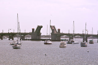
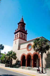
First, we explored on foot. We started with the tourist sites like the Castillo de San Marcos, the Bridge of Lions, the cathedral, churches, synagogue, and the old Spanish town. Flagler College, a former 'Flagler' resort from the 1880s, was astonishing. We just couldn't imagine being students in a place this beautiful.


Then we went further afield, walking across the Bridge of Lions to Anastasia Island where we climbed the lighthouse. (Yup, the water outside the inlet is the choppiest water for miles around... so it hadn't been our imagination.)


Next big hike was across the Vilano bridge, north of the city. Vilano Beach looks like a place trying to make a comeback. The town renovated the old bridge as a fishing pier, there is a new Publix in town, several new motels, and old ones being renovated. The beach is pretty interesting as people just drive onto the sand, park, and play. Simple, right?


Remember we attended IndiaFest in West Palm Beach? Well, there was another Indian festival in St. Augustine one day while we were there - the Festival of the Chariots - complete with a procession, music, and traditional dancing.


Of course we spent hours in the kayak over several days exploring the marshes and discovering how the tides change the character of the coastline. It was great to be able to get behind clumps of grasses when boat wakes threatened or the winds and currents made it just a little too hard to keep paddling in the open. One day we kayaked Salt Run, which borders state parkland, saw a baby sea turtle (lost?) and zillions of birds. Coming up on a sea of grass, about a half dozen great blue herons heard us and all rose into the sky at once. So rare to see many together. But the best part of the day was when 3 dolphins came to see us. They actually swam over and surfaced and looked at us several times. Wow! More about dolphins later...

We heard about the Lincolnville Farmers Market, so we set out for that last Sunday. Of course we got some beautiful vegetables and bread, but the best part was learning about the neighborhood on the walk over. Some wonderful Victorian era homes have been preserved, but better still, the Freedom Trail markers throughout the area outlined St. Augustine's role in the Civil Rights era. These markers tell the story so well, and are sad reminders that this really is very recent history.


We had a special day when two of John's West Point classmates and spouses came to meet us for lunch and a boat visit. It had been a long time and it was good to see everyone and catch up on what we'd been doing for the last 40 years. We won't wait decades to do this again.


Now about those dolphins. We think, but aren't sure, that we are hearing echolocation clicks at night. This sound phenomenon started while we were in Ft Pierce where we were surrounded by dolphins. At night, when we would go below, we would hear all this noise, but, there was no vibration in the hull. (Anyone who lives on a boat recognizes their boat's noises, and this one was new.). These are quick clicks, often layered. Someone suggested dolphin clicks, so we did a little research and learned that their sonar clicks strung together (called click trains) are how they find their way in murky or dark waters. So, makes sense that we would only hear this sound at night. And the layering effect would be from multiple dolphins echolocating at the same time, from variable distances to our boat. So, anyone who knows anything about this, please write in. We are stumped and would like to know if our theory is correct!